Basic Geology
The geology of this part of our local geography is a complex juxtaposition of geologically recent deposits belonging to the series Reading Formation. This in itself is a complex deposit of sandy clay, pebble beds and it is locally clay and glauconitic at its base. Above the Reading Formation is the younger London Clay Formation consisting of silty sandy clays, pebble beds and sand lenses.
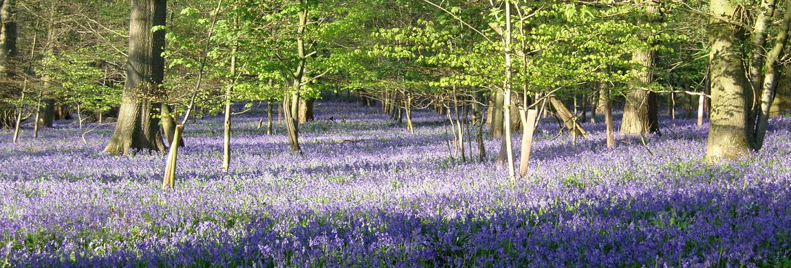
Both formations lie uncomformably on the various chalk formations that we are familiar with surrounding the Hampshire Basin and Salisbury Plain. The underlying geology is Reading Beds, overlain with an inlier of London Clay. This has a strong influence on the extensive woodland cover and the high proportion of oak trees within the hedgerows. The area drains into the River Dun via a number of small streams. Small ponds and lakes are a feature of the area. Along the river Dun there is a number of springs. Some of these dry up during long hot summers but one or two are known as perpetual springs.
One, for example, always produces water adjacent to Spring Cottage another, the Blue Lagoon, is on the river Dun (or Dunne) between West Dean and Holbury. Despite the proximity to the Dun it is rare for any flooding to take place. In part this is a consequence of careful maintenance and management of the sluices between Holbury Mill and Lockerley Mill.
For springs to occur the ideal conditions are a permeable, (porous or pervious) layer of strata above an impermeable layer. In our area these factors would be expected to occur where the younger sandier London Clay Formation overlies the older clay layers of the Reading Formation. The water table will fluctuate beneath these formations and it will fall from about May to September when evaporation exceeds precipitation and vice versa from October to April when precipitation and percolation exceed evaporation.
A very good example of spring line settlements on a bigger scale is where the chalk South Downs lie above the clay vales of the north edge of the South Downs.
Glossary of terms
- The Reading Beds and London Clay belong to the upper section of the geological era called the Tertiary and sometimes called the Palaeogene. The period when they were deposited is called the Eocene from about 70 to 40 million years ago.
- Unconformity: A break in the geological record, recognised where a set of rocks is overlain by another set which is not the next in the geological succession.
- Water-Table: The upper surface of the zone of saturation in permeable rocks.
- Glauconite: A blue-green coloured iron potassium phyllosilicate mica type of mineral which is a common component of greensand and has a marine origins.
Prehistory
The history of Lockerley is like a gem with its many facets such as the geology, sociology, agriculture, surveys, population census and archaeology reports. We can start with maps and browse other topics.
Maps, both current OS and past maps, and their recent companions LIDAR maps, help to give a topological foundation for the area and perhaps this following suite of topics will fire up contributions that expand and correct the texts that follow (please identify your sources though). And, in appreciating an area there is nothing quite like the simplest technique - walking the patch. Happy rambling and happy reading. There is a short section of references set out but more would be appreciated. topology
To start the thinking here are two aerial views of the area. If you are keen to pick out features in the LIDAR scan here are some challenges to pick out.
Butts Green's triangular form can be recognised. The railway line is clearly visible with the bridge and the footpath access towards Spearywell Wood beneath it. The church of St John. The river Dun, its flood plain and the straight lines which indicate initial work on the canal. The early earth work - looks like a backward C. The indication of a long lost track from the earth work towards Holbury crossing what is now known as Critchells Green; it goes approximately ENE. The evidence of the railway sidings installed as part of D Day preparations.
The other image comprises, on the same scale, a merged version of the height variation with a colour image of the same area. Butts Green's triangular shape is a little more easily discerned. And, apologies, at this time the image covers only lower half of the LIDAR scan. North is up - as ever (not quite so with the LIDAR scan) - and the railway line should act as a guide if you try to line this up to an OS map. Then , if your interest is piqued, take some time out with the facility at the resource provided by the National Library of Scotland. Go to Top
The Name
The village name is known in the Domesday Book as Locherlega, 1086; Lokerlay, 1194; Lockerleye, 1271. Coates in 1989 suggested the name probably contains the Old English ancestor of Middle English lokere=looker possibly derived from the anglo saxon (with possible roman influence) of loca meaning enclosure. Lokere means keeper or shepherd and leah (from the Old English meaning a ley or open place in a forest) thus maybe indicates a shepherd's clearing or wood. Go to Top
Before the Normans
Lockerley has been known as a habitation since iron age times as earthworks in the area testify. Lockerley Camp – to the left on the road from Lockerley to Awbridge at Ordnance Survey reference SU 304 259 and approximately between Canefield and The School Farm – is a univallate nearly circular earthwork of 2.1ha, situated on a low gravel-capped plateau though it has been reduced by ploughing.
A keen eyed, and experienced archaeologist, will often find items such as a flint arrowhead when walking along the footpath between the Old Post Office and the railway bridge. Archaeological findings in the Lockerley area include some roman coins and pottery dating around AD 259-350 which were found in an earthwork near Holbury Farm known as Holbury Wood Camp. Palaeolithic artefacts have been recovered from gravel pits at nearby Dunbridge and Kimbridge. A recent digging foundation for a garden wall revealed some mesolithic stone implements and this suggests that Lockerley and its area has been in the flux of human activity and live since before 4000BC.
The image in the head of this section shows a LIDAR map and resulting topological map that shows this well. Go to Top
Norman period
The Domesday Book of 1086 records three manors and one hide (a hide is an area of land approximately equal to 120 acres) as belonging to the Bishop of Winchester. The manors were held by an overlord who, in turn, leased them to an underlord; this is known as alod. Prior to the Norman invasion of 1066 someone called Star (Sterre) held the manor from Edward the Confessor (b ca 1003 and ruled 1042 till his death in January 1066) in what was called alod (a freehold not held by the sitting lord). We might suggest that this name lives on in the name of the Star Inn which is located between East Tytherley and Lockerley but there is no evidence for this.
Following the Norman conquest the lands came into the possession of Hugh de Port as part of his 55 manors in Hampshire (Hantscire). The Domesday Book entry records that the land of Hugh de Port was located in the Broughton (Brocton) hundred (a hundred being an area of land equal to 100 hides) and included a manor in Lockerley which Star held from King Edward in freehold as a manor. Then (1066) and now (1086) it paid tax for one hide, land for three plough and, in lordship, one plough, four small holders and four slaves with half a plough. A mill at 10s (a shilling is equivalent to 50 pence), meadow six acres and woodland at three pigs. Star also held one hide which was part of the king's forest. This latter reference possibly indicating the extent to which the New Forest was at that time established.
A second manor had been held by one Wulfric from King William (the conqueror) and his father apparently held it from King Edward (the confessor). Wulfric had inherited one hide from his father and this was located in East Tytherley. A third manor was held by one Alfwy who held it from the king and who, prior to 1066, held in alod from King Edward.
For greater accuracy and a better overall view it may be useful use tithe (aka tythe) maps to study the land ownership at this time over the area including Broughton, Mottisfont, East and West Dean, Lockerley, East and West Tytherley, Sherfield English. These maps are early surveys on behalf of the land owner that identify field boundaries, their usage and their area (approx 2.5ha to an acre). The were used to set the tithe, tax or rent that the lease holder needed to return to the landowner. Go to Top
Boundaries
The village is possibly the conflation of three populations which may have existed as identifiably separate entities 1000 years ago. Lockerley, as it is presently known, is the main village and is centred around Butts Green. A second village called Lockerley Green seems to have existed at some period in the middle ages.
Lockerley Green is adjacent to a hamlet known as Holbury. Lockerley Green still exists by that name though it is now one of Lockerley's four principal greens and is part of the overall Lockerley parish. Holbury was, at times past, considered part of East Tytherley. East Dean parish might have included the area on the west side of Lockerley Green and it still includes habitations on the southside of the railway line which are reached from Lockerley's Top Green.
This confusion seems to have persisted until quite recent times until it was decided to place the west side of Lockerley Green within Lockerley parish. East Dean parish boundary was moved a small distance and now no longer bisects a house on the corner of the green and East Dean road. It includes some property on either side of the railway line which would otherwise be considered as being on the Top Green of Lockerley but, technically is in East Dean. Go to Top
The people and population
The village has some 324 dwellings which are home for around 827 people (2001 census). Butts Green owes its name to the period following 1538 - the period of the dissolution of the monasteries, when a royal decree required each able bodied man to spend an hour each Sunday at archery practice. The archery target is known as the butt from the old french “but” and this is meaning of a target is one which the modern french word retains. The law is still in force though few observe it; indeed, one doubts that current Health and Safety regulations would permit it and the carrying of arms in a public place would be a hazard - such be life.
The Glebe Field is leased to the Parish Council as a facility. It is, in essence, a sort of managed common land. It can be used by scouts and guides who may use the scout hut and its resources particularly in summer months when the field is used for camping and, for that reason, if no other, walking dogs on it is forbidden in any season.
If you are responsible for a dog please take its output home with you for safe disposal. Such stuff does not belong hanging in plastic bags on twigs or kicked to the undergrowth. There is no dog shit fairy.
This may go some way - only - to explaining why the Lockerley church - the original building of which was established ca 958 AD - is so far from the population centre of either major parts of the village and explains why Lockerley village is possibly one of the larger village parishes in Hampshire in terms of the area covered. As is apparently not uncommon the site of the church might be co-located with earlier roman places of worship. Go to Top