In the Beginning
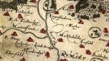 (Lockerley from a map of 1575). At the time of the Domesday survey Lockerley was a chapelry annexed to the church of Mottisfont. The name is entered as Lockerslei and Lockerlega and it is considered likely that the original simple chapel was built by William Briwere, founder of Mottisfont Abbey in C1200. The image here is of a model of the saxon church which was mad prior ot the felling of the saxon building. The photo below suggests that this was a fairly accurate model. The present church was consecrated on October 16th 1890 and was built alongside the old Saxon church which was demolished. Go to Top
Parish Register
The parish registers of births, marriages and deaths date in unbroken sequence from the first Queen Elizabeth's reign in 1583 and records the names of generations of former worshippers, many of them ancestors of families still in the parish, such as Dennet, Moody, Collins and Betteridge to name but a few. Amongst the parish registers a loose sheet of paper dated 1745 gives a seating plan of the old church. Familiar family names reappear, Edney, Betteridge, Pragnell and amongst the houses to which seats are allocated are The Manor Farm, The Charity School Farm and Painshill. There were separate seats for strangers and also Wummen's Setes! The foundation stone of the present church was laid on 10th August 1889 by Frederick Gonnerman Dalgety of Lockerley Hall and he built the church at his sole expense. Go to Top
The Old Church
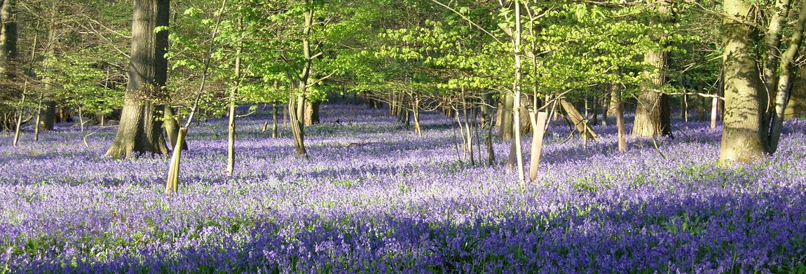
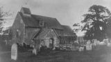 The 1855 census describes the old Saxon church as “a small mean building with tile roof and wooden belfry containing two bells”. Perhaps this is why the Dalgety family felt the need to replace it and build something victorian. In the churchyard in spring, rows of daffodils mark the outline of the walls of the old church; the cornerstones remain and an old tombstone placed horizontally marks the site of the altar. A model of the old church, presented by Captain Dalgety, is on view in the porch. Little else remains of the old church; once again in the porch, you will notice the old font and, set in the wall above the inner doorway, are the weather cock and a piece of carved oak from the gallery. Go to Top
Points of Interest
The most interesting relic is the stone frame of a small Norman window which is now set in the South transept of the church. This was found discarded under a tree in the churchyard and is thought to been used as a leper or squint window. All the other points of interest date from the time of the building of the present church and may reflect life at the end of the late 1900s. It is reputed, for example, that the Dalgety crest above the small side entrance in the South transept signifies that this door was for the exclusive use of the Dalgety family. Older parishioners talk of the Dalgety pew in the south transept. The paintings on either side of the altar were painted in Victorian style to depict the elements of the old testament - from left to right, Sarah and Abraham represent Faith (tested when God commanded Abraham to sacrifice Isaac), Melchizadek represents Sacrifice (holding a chalice foretelling the chalice of Christ's blood) and Moses holding the stone tablets of the ten commandments represents Law. It is said that during the blackout of World War II, when services had to be held in the afternoon, the winter sun reflected in the gilding of these paintings lighted the church. Go to Top
Centenary year 1990
To celebrate the centenary of the church in 1990, 100 kneelers were made by people in the parish, mostly to their own designs. They, in their own way, reflect life at the end of the 20th century and continue the thread of dedication and worship at Lockerley. Go to Top Churches Within the bounds of the United Benefice of Lockerley East Dean, East and West Tytherley there are five churches. Records identify the St Johns as extant in 958AD and it is likely that the charmingly simple building of East Dean has a similar pedigree. Shown in the sketch above is St John's before its demolition and replacement . There is a charming water colour (left) by Jane Austen's elder sister Cassandra showing the old St John's church in 1787. It is a view from the river Dun and shows the rectory as it was at the time. A further sketch shows the church at possibly the same era and this correlates well with one of the photgraphs taken much later. The original churches of East Tytherley and West Tytherley were replaced by victorian edifices. The Providence Chapel - shown on the 1892 OS maps - the Baptist church - on Lockerley Green is a plain edifice which dates from the late 19th century. Go to Top
Lockerley Manor
In 1293 the manor in Lockerley was granted to John Butler (Le Boteler) by King Edward I (b 17 June 1239 and ruled from 1272 till his death in 7 July 1307). Information on the other two manors referenced in the Domesday Book may possibly found by researching the history of Holbury and East Tytherley. In this period the name was spelt Locherslei but it was also known as Lockerley Boteler and Lockerley Butler. As it happens, Butlers Close is named after Stephen Butler a parish councillor ca 1960 and he is not, knowingly, related to the historical reference. It is possible that the location known as Butlers Barn, in Mount Lane, may reflect the earlier historical ownership. John Butler died in 1310 and he left the manor to his son (also John) who, in turn, designated it to his mother as a dower until her death. Of local note one John Payne was known to hold the area known as Painshill because, between 1333 and 1345 (his death) he had acquired a licence from the Bishop of Winchester to hear divine oratory within his home due poor health. This area is very likely to be that currently known as Painshill Farm and the lane leading to it south east from Lockerley is known as Pains Hill. Go to Top
East Tytherley and the first plague
In 1346 Holbury - which was also included within East Tytherley at the time - was used by Queen Philippa. She was 16 when she married the 15 year old King Edward III in York Minster in January 1328. He was just in his first year as reigning king following the deposition of his father Edward II in January 1327. She seems to have had the use of the place since 1335 and she moved there with her court in order to avoid the first wave of the Black Death. It seems that two of her court were, or became, infected and that much of East Tytherley succumbed. Historians estimate that the typical cull of the black death - bubonic plage - was around 30% and that infection was very rapid. The disease had three forms. The mildest was around 80% fatal within seven days whilst the fastest, the septicaemic form which produced the dark patches under the skin known as purpura, was nearly 100% fatal. Historians suggest that the likely source of the disease was the far east and that the likely entry point may have been the mediterranean Genoese and Venetian traders who worked into Southampton and Weymouth. Phillipa lost two of her 14 children to the disease in 1348.
It's possible that the area of East Tytherley and Lockerley were strongly affected also and that might explain the absence of a village centre for East Tytherley though there is evidence that there was habitation - now vanished - in Buckholt. One side effect of the royal court sequestering itself in East Tytherley was a dislike in the area for royalty. This dislike was not shared by the neighbouring West Tytherley and so each village supported a different side during the English civil war. In 1348 John (son of John Butler) requested a licence from the king to have the Lockerley manor settled on himself and his wife Margery. He died in 1349 but the licence seems to have been granted to his son and heir some time later - in 1375. One Lewis John - a nice coincidental twist given the model farm operated by the John Lewis partnership in Leckford a few kilometres north out side Stockbridge - held the manor in custody for the heir of a person by the name of Francis Court. By 1476 the land at Holbury and Lockerley was included within the manor of East Tytherley. The manor at East Tytherley was probably that identified as held by Gilbert de Breteuil in 1086 as an overlord and previously held by Chening in alod from Edward the Confessor. Go to Top
The Middle Ages
History passes and somehow the manor passes back to the crown which, in 1493, granted it to George Bainbridge. He was also granted East Tytherley manor in 1496 along with Butler's estate in Lockerley. In charting the passage and use of land it might be useful to access the tithe maps for farms in this area such as this one for the Gambledown area. These maps are also a primary resource in establishing the rights of passage along footpaths. Where a passage between two places follows the borders - or it may be across a field - leased or owned by more than one person then there exists a de facto right of passage. This right can not, in principle, be taken away - it is for all time and does not evaporate if the route is no longer used. A large number of common land and concomitant rights of way were removed during the ages of the Acts of Inclosure (see the WikiPedia page for a brief introduction). The impact of these acts can be seen in those counties where the act was more energetically carried out. Hampshire - in general - seems to have not been as extensively affected and there exists in Hampshire a healthy collection of such rights of way. Since ca 1923 county councils have had to identify rights of way and to publish the details on Definitive Map of Rights of Way. Broadly they are responsible for the maintenance of the access points - stiles and gates - to the paths and this is a responsibility that rests also with the landowner. Go to Top
Dissolution of the Priories and Monastaries
Henry VIII dissolved, or disestablished, the monastaries in 1538 and granted the manor to Francis Dawtry. The history is once again murky because a certain Thomas Jeay died in 1626 leaving Lockerley manor to his son Stephen and yet it seems that Dawtry's nephew, George Thorpe, sold it to a Richard Zouche (a jurist born in Anstey in 1590 and died 1 March 1661 who was MP for Hythe (Hampshire) in 1621 and 1624). Zouche also owned land in Lockerley and East Dean. The years do not quite add up and further research is needed. During this period Lockerley manor appears to correspond to Lockerley Water Farm which lies across the road from the Ford Mill. It should not be confused with Lockerley Hall nor, it would seem, with the place currently called Lockerley Manor which lies between Mount Lane and Pains Hill. Go to Top