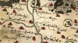
Lockerley is a small village in the Test Valley, Hampshire, England. The river Dun, a tributary to the river Test, flows through it. It has a population of around 330. Lockerley is roughly 34m ASL (railway line level at the bridge between Lockerley Green and Top Green). The centre of Lockerley Green, which is where many GPS systems will lead you, is at OS reference SU 291 267.
The What3Words for this location is loose.nuzzling.claps. You will need to create an account at W3W in order to more fully use the app. In an emergency simply waking up the app may show your current W3W and location provided that there is, at least, a sniff of 4G that your 'phone can receive. It's worth having this app - it may save a life.
Mobile phone coverage particularly in rural areas is criminally low – no obligation for mobile universal coverage was made despite the increasing requirement to connect any where any time. Home based WiFi calling does not help mobile users such as delivery drivers and those relying on GPS and phone apps for directions. News ... A recent eveloment (May 26) has resulted in large green cabinets being planted on the patch of land by the side of the scout hut. An aerial pole - standard colour forest green - has been installed. It would need to provide a 4G service as that is the only truly universal protocol suited for rural coverage and it may be the only one which willl enable so-called SMETS2 smart meters to function.
Lockerley has a First Responder team which may be called out by the ambulance service. Call 999 and ask for ambulance. The ambulance service will contact the First Responders. In an emergency there are two defibrillators – one by the village shop – washing.ribcage.camps -and the other is located in the entrance to the village hall W3W acrobatic.hope.wobbling.